
The forecasts began coming in this morning: Heavy rainfall expected over the next two days. Possible flash flooding. Turn around, don’t drown.
These advisories buzzed up from local news media for the DC, Maryland, and Northern Virginia metro areas as a crazy, wavy Jet Stream spawned an upper-level low that’s predicted to gorge on an insane amount of moisture spewing up off the record-hot Atlantic Ocean.
Forecast GFS model guidance shows an upper-level low-pressure system situated over the Great Lakes region in association with a big trough dipping down from the Arctic. Over the next 24 to 48 hours, the low is expected to shift south and east. Becoming cut off from the upper-level flow, the low is then predicted to set up a persistent rainfall pattern over DC, Maryland and Northern Virginia.
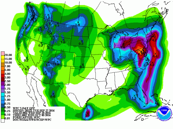
(NOAA’s precipitation forecast model shows extreme rainfall predicted for the DC area over the next seven days. Note…
View original post 1,235 more words
