
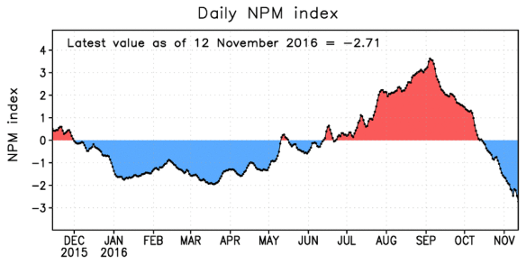
Just a few weeks ago I highlighted the return to a strongly positive phase of the North Pacific Mode (NPM), caused by persistent high pressure over the northeastern Pacific Ocean during summer. Well, it didn’t last long. The circulation pattern has undergone a dramatic reversal, with numerous strong storms across the North Pacific, and sea surface temperatures have dropped precipitously in the “blob” region. The chart below shows the daily evolution of the NPM index, which has dropped from above +3 in early September to well below -2 in recent days.
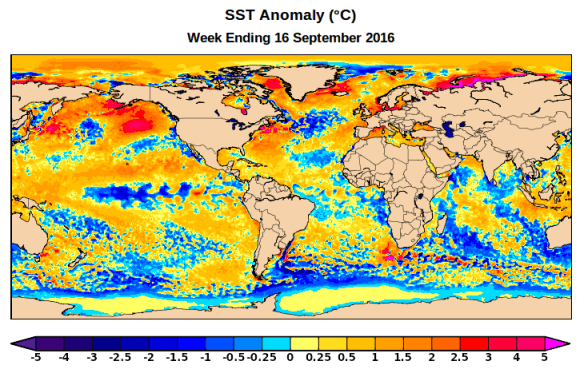
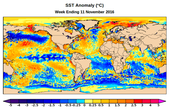
A comparison of weekly SST analyses from mid-September and from last week shows the contrast – a remarkable band of significantly cooler than normal SSTs now stretches from Sakhalin almost to the U.S. west coast.
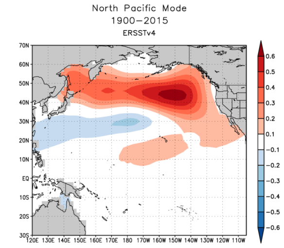
Notice how well the new zone of cool water lines up with the area that contributes significantly to the NPM mode:
Here’s the sea-level…
View original post 91 more words
