
 Image copyrightGETTY IMAGES
A respiratory virus first detected in the Chinese city of Wuhan has now infected thousands of Chinese citizens and spread to a number of other countries.
The fast-moving infection, which causes pneumonia-like symptoms, has been declared a global emergency by the World Health Organization.
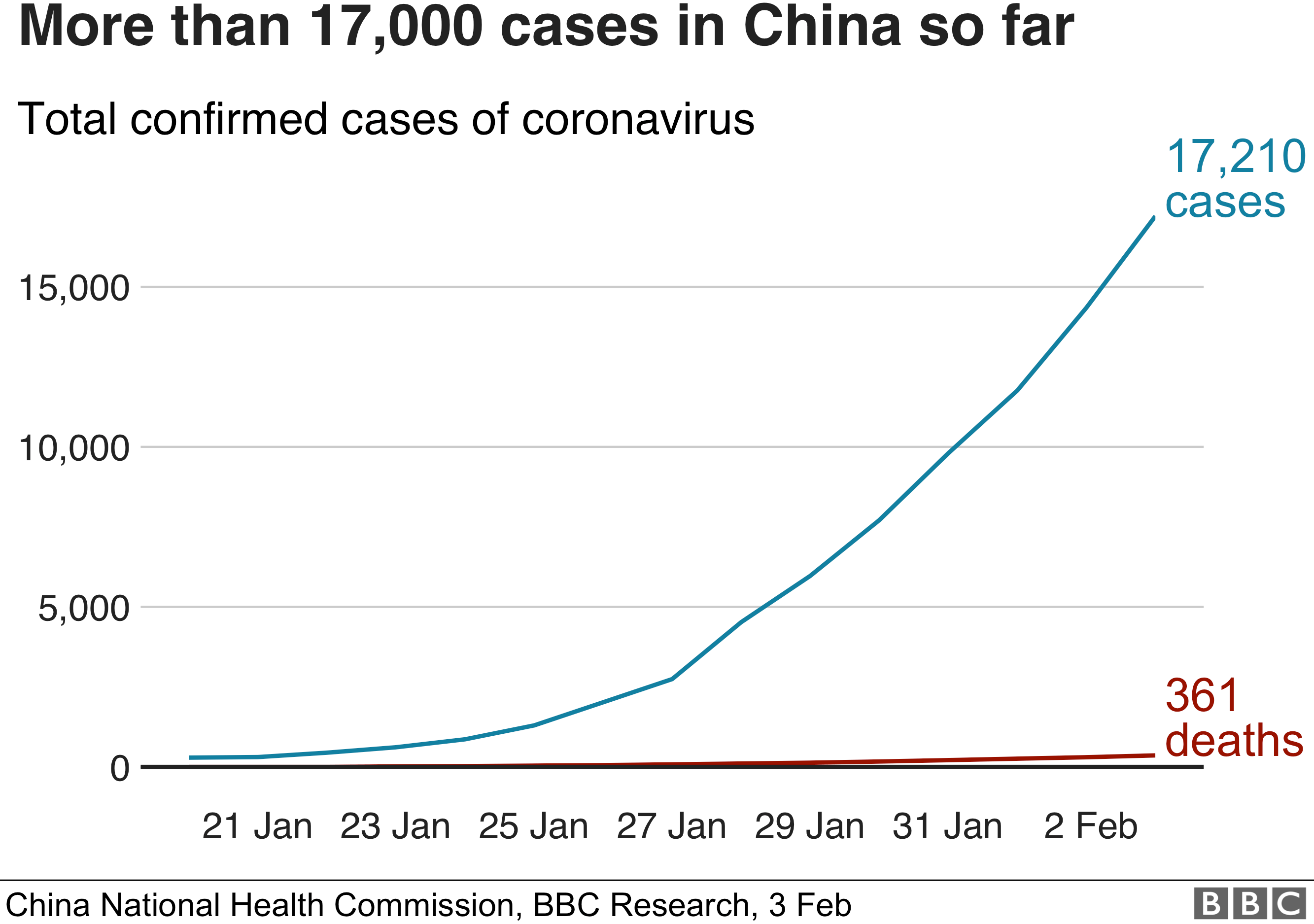
It has claimed more than 360 lives and prompted Chinese authorities to quarantine several major cities.
Here are six maps and graphics that will help you understand what is going on.
1. Cases have been mainly in China
Thousands of confirmed cases have been recorded across China, with central Hubei province the worst-affected.
The World Health Organisation (WHO) is warning the number of cases is likely to rise further, and Chinese authorities have introduced a number of measures to try to halt the virus’s spread.

Travel…
View original post 1,342 more words
