
The hunt for Japan’s ‘ghost’ wolves

The frozen ship drifting to the Pole

The fight to stop the ivory poachers
The ‘dead zone’ hiding great riches
W
We hear the ice before we see it. The first sound is a scraping whine as a chunk of ice etches its way down the hull of the ship. The shelves creak as the cabin starts to shake. Out the window, I see a piece of ice floating 10m (33ft) or so away – a bluish, three-humped blob about a metre (3ft) across. It bobs up and down in the waves.
Then a few more rounded and weathered chunks appear. Another one hits the hull with a heavy clonk, and we hear it bounce below the waterline three or four times as it moves down the side of the vessel.
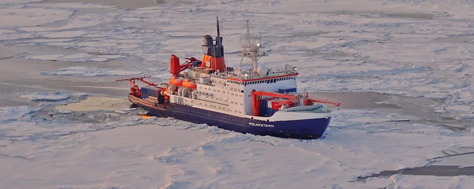
The ship I’m on – the German icebreaker Polarstern – is making its way north to the edge of the Arctic sea ice to find a floe to moor itself too. There, more than a hundred scientists will set up a floating city on the ice. The expedition, known as Mosaic, seeks to build the first detailed profile of the Arctic environment year-round by spending a year trapped in the sea ice. (Read more about the Mosaic mission to the Arctic.)
You might also like:
• Why the Arctic is on fire
• The wall holding back a desert
• The ancient memories trapped in the world’s glaciers
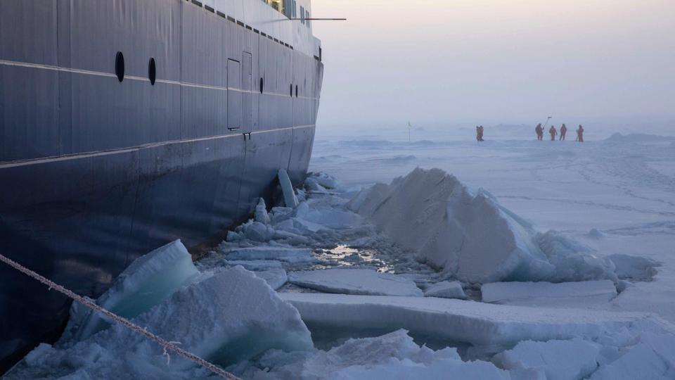
The first obstacle standing in their path, however, is the ice itself. Not thick, impassable ice that leaves the Arctic Sea impenetrable at the height of winter, but rather the lack of it. They need a substantial floe strong enough to support the research base they are hoping to build.
But the ice is getting less extensive each year, and it is also getting thinner. The strong ice necessary to support large infrastructure – not least a runway and a 30m (98ft) tall meteorology tower to be used by Mosaic – is growing scarce. Climate change has lent an urgency to the mission.
Mooring the ship to an ice floe that is too thin is risky as it could easily break up in storms or the ocean currents (Credit: Sebastian Grote/AWI)
“This may be one of the last years we can do this kind of expedition,” says Matt Shupe of the University of Colorado, who first began planning the mission 10 years ago and now leads its atmospheric research programme. He is one of hundreds of scientists taking part in the expedition in the hope of unravelling exactly what impact global warming is having in the Arctic, and what the consequences will be for the wider world as the environment around the North Pole changes. I am one of the few journalists to be invited to witness the work they are doing.
It is our fifth day at sea when we first meet ice, high within the Arctic Circle at a latitude of around 81 degrees north. Ahead of the ship is the first stretch of dense ice that Polarstern must navigate. This tendril of frozen ocean extends down from the ice cap, brushing past a trio of remote Siberian islands. We skirt past the islands, aiming for a narrow band of less densely packed ice that should give us easier passage. From there, we head a little further east before the Polarstern turns north to crush its way into the densest, central ice.
“When we first came to the North Pole with Polarstern, we needed another icebreaker to assist us through the ice,” says expedition leader Markus Rex of the Alfred Wegener Institute. “Last time, the ship just cut through the ice easily alone.”
Sometimes this elastic-looking ice becomes milky and whitish, flexing with the shape of the wavelets
After hearing the impact of the first isolated lumps of ice bashing into the hull, I start listening out for our first full-on icebreaking. I become aware of tiny sounds and vibrations in the ship, going to the window to check each time. “When you hear it, you’ll know it,” says my cabinmate, Nicole Hildebrandt, a zooplankton researcher at AWI.
Out on the deck, the chunks of ice become gradually more frequent and larger, their irregular shapes below the waterline sometimes bright turquoise. Others are brown, coated underneath rotten ice rich in diatoms, algae and occasionally sediment. In the open water between these stretches of ice, the waves have died down from four metres high (13ft) to almost nothing, giving the ocean a glassy surface.
In the open stretches, I start to notice strange structures just below the surface. They look like jellyfish – translucent and almost invisible – suspended just below the surface of the water. This is the seawater starting to freeze. It stretches out in broad fronds in the direction of the wind. Sometimes this elastic-looking ice becomes milky and whitish, flexing with the shape of the wavelets.

On the bridge of the Polarstern, volunteers take turns looking out for the changing ice conditions while the crew search for the right floe to moor to (Credit: Esther Horvath/AWI)
As we travel further in, Stefan Hendricks, one of the expedition’s ice team, asks for volunteers for the ice watch, to log observations of the amount and types of ice we pass through. I sign up for a daily slot. On the bridge, Hendricks tells me the names for the different kinds of ice that I have been noticing. They have poetic names: frazil, shuga and nilas ice. Then there is pancake, grease and cake ice.
As sea water freezes, it first forms crystal discs known as frazil, eventually forms a suspension in the water known as grease ice, which creates an iridescent sheen like an oil slick. Waves and wind can compress the ice crystals together to form pancake ice that floats on the ocean surface. As these pancakes grow bigger they become cakes. On calmer seas, the frazils grow to form a continuous expanse of dark, glassy layer of ice, like a windowpane on top of a black sea. Shuga ice is slushy mess created by spongey white lumps that bob in the water.
We travel past most of these different types, but looking out from the bridge windows across this forming ice-scape, I scan fruitlessly for elusive frost flowers that Hendricks tells me can occasionally be spotted.
We feel the ship fall heavily back to level and then tilt briefly to the other side, accompanied by the sound of large pieces of ice booming into the hull below
When we eventually encounter thicker ice on the fifth day, the sensation of the ship breaking through is indeed unmistakeable. From the centre of the ship in the Red Saloon, the faint sound of scraping along the hull grows a little louder and the ship begins to judder. Then the ship hits a large section of ice and pitches sideways, sending my coffee climbing diagonally up one side of the glass mug it is in.
Those of us in the saloon lean over to keep our balance. After what could be 10 seconds or so, we feel the ship fall heavily back to level and then tilt briefly to the other side, accompanied by the sound of large pieces of ice booming into the hull below. We encounter these very large pieces of ice a few times an hour, usually catching us off-guard, amid the more constant gnawing, shaking and bumping through the thinner ice.
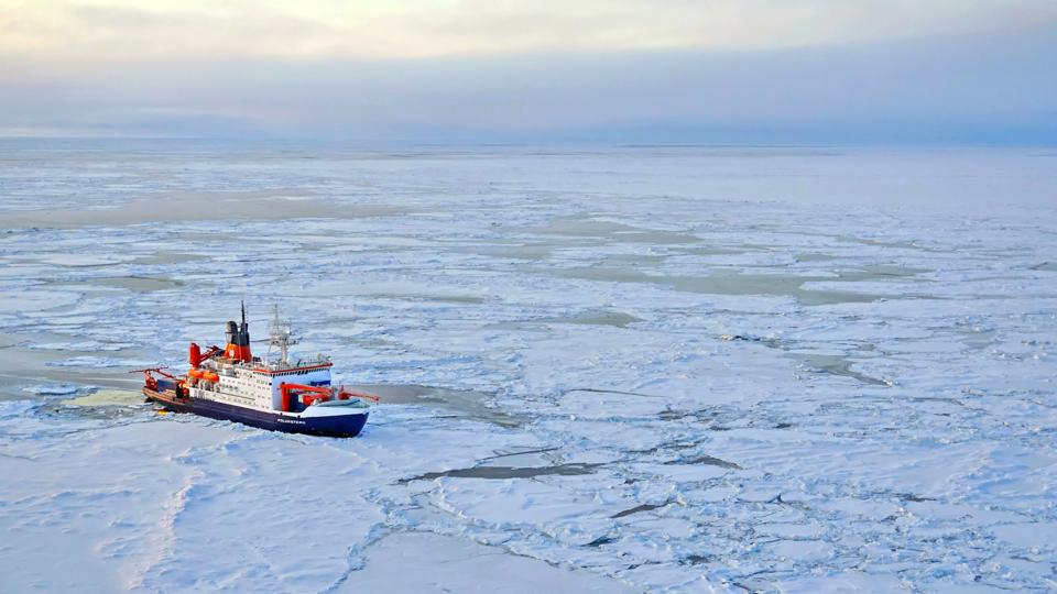
The Polarstern needs to find a stable ice floe on which to set up its research base before the long winter darkness sets in (Credit: Markus Rex/AWI)
Researchers at Russia’s Arctic and Antarctic Research Institute have been tracking likely ice floes for Mosaic in the Central Arctic Ocean all through the summer. They have been using data from several satellites, hoping to find those which have survived the storms and melting. Before departure in Tromsø, on the Norwegian coast, Rex showed me images of the target region he had in mind. It was a region at around 85 degrees north and 135 degrees east.
“There we will find our sweet spot,” he says, pushing his glasses up to his forehead and looking at an app on his phone. The screen shows black and white specks – how the ice shows up in the images. He points out a darker oval in the image – the darker the ice appears, the thinking goes, the thicker and more robust the ice should be. The ice in the target region is looking like it will be 80cm thick, according to the data available. “We’d prefer one metre, one metre 20 (3 to 4ft) – but 80cm can work,” says Rex.
There is a week or so budgeted to find the right floe. Once safely moored, the ice will freeze around Polarstern, trapping the vessel and its crew in place so they will drift with the floe on an unpredictable path across the polar region, creeping on average from east to west through the year. But, choose a bad floe, or even a good floe in the wrong place, and the camp is at risk of collapse. “It’s the only real decision, the only degree of freedom we have,” says Rex.
What happened to N-ice would be really, really bad. We need to avoid that – Markus Rex
In the Blue Saloon, a formal room named for the colour of its carpet and chairs, the leaders of the expedition meet to discuss the preliminary results of their search. They sit at a large round table, books on Soviet Arctic research and polar wildlife on glass-fronted shelves behind them. Rex reopens his laptop and pulls up a map of the Central Arctic.
“This is the statistics of how the drift will happen based on the selection of our starting point,” he says, pointing to a spaghetti diagram of multicoloured lines across the map. Each line represents the drift trajectory of ice at a given starting point for the past 12 years, based on tracking features in the ice from day to day. Rex fiddles with the settings on the app and the team around the table lean in to see, setting a starting point of 120 degrees east and 85 degrees north.
“A large fraction ends up in the N-ice area,” he says, with a glance around the table. “And you know what happened to N-ice.”
N-ice was a smaller scale Norwegian Arctic drift expedition in 2015, whose floes kept breaking up as they drifted into the warm Atlantic swell. It meant that the group had to disband their camp and relocate several times. “What happened to N-ice would be really, really bad. We need to avoid that. We can’t allow drift trajectory that goes into that area,” says Rex. “We can’t completely rule it out, and we might end up in an N-ice-like situation but we don’t want that.”
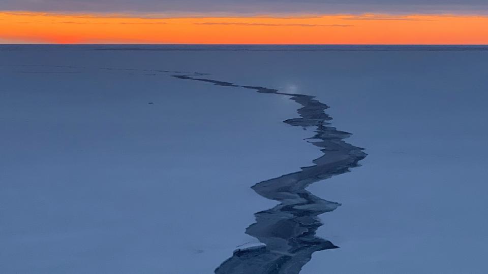
Large cracks can appear in the sea ice within a few hours and then can disappear again almost as quickly in the fast changing Arctic environment (Credit: Sebastian Grote/AWI)
Rex tweaks the parameters again, to a starting point around 135 degrees east, 85 degrees north. “This is more the type of drift we want,” he says. Many of the colourful squiggles work their way up over the North Pole and down towards the western side of the Fram Strait. But some of the lines are curtailed, ending their year’s drift still stuck at the North Pole. “There is a large uncertainty still, as we see,” says Rex. “One of these trajectories gets into a danger zone off the coast of Greenland.”
The team flick through different scenarios. Some starting points end up in dangerous areas, while others meander out of the High Seas and into the Russian Exclusive Economic Zone, where the team does not have permission to do research.
But ensuring the ship doesn’t drift into a problematic area is only one of the factors that will determine the success of the expedition. Another is the resupply missions for the ship, which will also be used to exchange crew and scientists on board. None of the team is staying for a full year, with most only there for one leg of the expedition. If Polarstern drifts too far into thick winter ice, or out of range of the supply aircraft – two research planes and Russian long-range helicopters among them – then the scientists risk being cut off.
With all these requirements in mind, a spot at 135 east and 85 north soon appears to be the only region that stands a likely chance of meeting the mission’s requirements. “It’s not guaranteed,” says Rex. “Nothing is guaranteed on this expedition.”
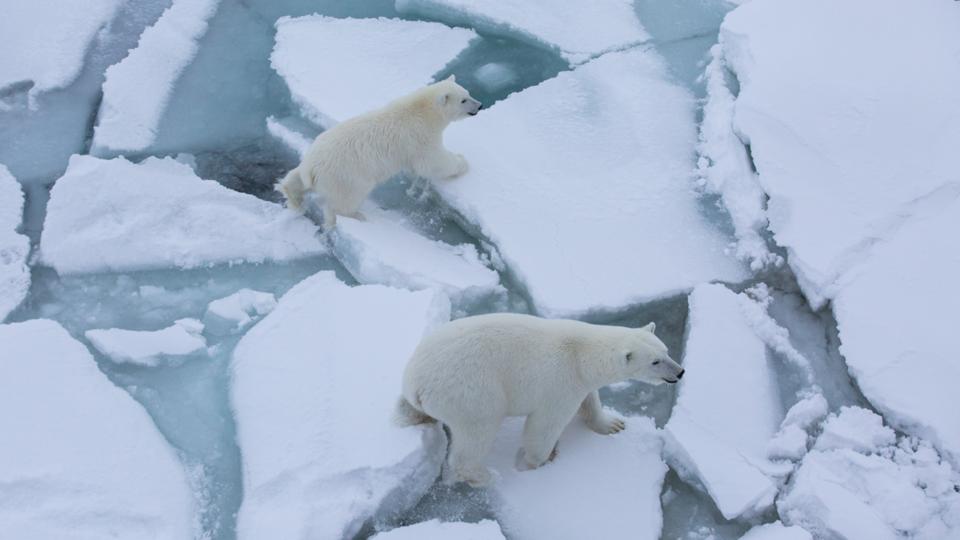
The thin ice that has posed problems for the expedition could also be a growing issue for the polar bears that live in the Arctic (Credit: Esther Horvath/AWI)
More:
